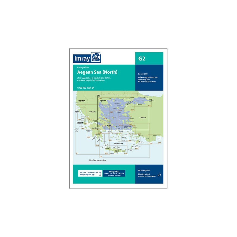
A passage Chart (G2) of the North Aegean Sea, Turkish coastline, approaches to Istanbul and the Dardanelles.A passage Chart (G2) of the North Aegean Sea and Turklish coast linewith a scale of 1:750,000 WGS 84Our catalogue of yachting charts is regarded by

A passage Chart (G2) of the North Aegean Sea, Turkish coastline, approaches to Istanbul and the Dardanelles.
A passage Chart (G2) of the North Aegean Sea and Turklish coast linewith a scale of 1:750,000 WGS 84
Our catalogue of yachting charts is regarded by the sailing community as the most comprehensive available. Our paper charts are complemented by a growing list of electronic publications and high quality pilot books by leading authors.
Dimensions: 90.5 cm (Horizontal) x 64.5 (Vertical)
Plans included:
This 2013 edition has been fully modernised and updated throughout.
G2 Charts:


Reviews
There are no reviews yet.